1
Contents
Creating New Stations
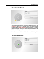
When the Instrument is Leveled
When the Instrument is Misleveled
Setting up a Station with Known Coordinates or Azimuth
Creating a Station Known Point
Importing a List of Known Points
Selecting a Station Known Point
Setting the Station Parameters
Orientating a Station With
Setting up a Station Using Multiple Point Resection
Creating the First Backsight Known Point
Importing a List of Known Points
Selecting the First Backsight Known Point
Setting the First Backsight Parameters
Measuring the First Backsight Point
Creating the Second Backsight Known Point
Importing a List of Known Points
Selecting the Second Backsight Known Point
Setting the Second Backsight Parameters
Measuring the Second Backsight Point
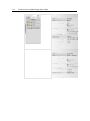
The Target-Based Registration Report by Stations
Ending the Station Setup Using Multiple Point Resection
Stationing Review in the Project Tree
Setting up a Station Based on Three Backsight Measurements
Defining a New Station Name
Creating the First Backsight Known Point
Importing a List of Known Points
Selecting the First Backsight Known Point
Measuring the First Backsight Point
Creating the Second Backsight Known Point
Importing a List of Known Points
Selecting the Second Backsight Known Point
Measuring the Second Backsight Point
Creating the Third Backsight Known Point
Importing a List of Known Points
Selecting the Third Backsight Known Point
Measuring the Third Backsight Point
The Target-Based Registration Report by Stations
Ending the Station Setup
Stationing Review in the Project Tree
Not Setting up a Station
Defining a New Station Name
Stationing Review in the Project Tree
73
75
76
77
77
78
80
81
83
100
100
101
103
104
104
105
106
107
107
108
109
110
111
114
114
114
115
118
118
119
120
121
121
122
123
124
124
125
125
126
128
128
129