1
UtilityScan
Solutions
Survey Solutions
Survey Cart Options
Rugged Cart
Utility locators, construction professionals,
environmental firms and land surveyors need a
reliable, non-destructive method to locate subsurface
targets prior to digging, trenching, conducting site
assessments and mapping.
•
•
•
•
•
•
•
•
•
•
Locate and Map
Underground Utilities
Designate the location and position of metallic
and non-metallic pipes in real time using the
GSSI UtilityScan. GPR can enhance one’s
overall understanding of subsurface targets and
obstructions.
Weather resistant design
Multiple antenna options (2600 MHz to 270 MHz)
Internal integrated survey wheel encoder
Removable, 16 inch wheels (41 cm)
Marking paint can holders
Compatible with SIR-3000 control unit
Dimensions: 30.1 x 47.9 x 41.8 inches (76.4 x 121.6 x 106.1 cm)
Antenna centerline to front of cart: 19 inches (48.3 cm)
Weight: 58 pounds (26.3 Kg)
Model 643
Compact Cart
•
•
•
•
•
•
•
•
•
Compact, weather resistant design
Multiple antenna options (2600 MHz to 400 MHz)
Internal integrated survey wheel encoder
Removable, 12 inch wheels (30 cm)
Compatible with SIR-3000 control unit
Dimensions: 24.3 x 39.4 x 40.3 inches (61.7 x 100 x 102.4 cm)
Antenna centerline to front of cart: 15 inches (38.2 cm)
Weight: 48 pounds (21.7 Kg)
Model 653
Standard Cart
•
•
•
•
•
•
•
•
•
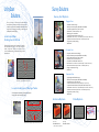
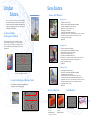
UtilityScan data showing a duct bank with five utilities.
Also shown is a well-defined excavation trench.
Locate Underground Storage Tanks
Use UtilityScan to accurately pinpoint underground
storage tanks and associated piping.
Lightweight and foldable design
Multiple antenna options (2600 MHz to 400 MHz)
Integrated survey wheel encoder
20 inch front and 24 inch back wheels (51 cm, 61 cm)
Compatible with SIR-3000, SIR-20, SIR-2000 control units
Dimensions: 24.9 x 53.3 x 45.8 inches (63.2 x 135.2 x 116.3 cm)
Antenna centerline to front of cart: 31.6 inches (80.2 cm)
Weight: 39 pounds (17.7 Kg)
Model 623
Antenna Options
Data Options
0 - 12 feet*
(0 - 4 m)
400 MHz Antenna
Real-time 2D Profiles
Rebar in concrete pad
Edge of excavation
3 USTs
UtilityScan data depicting storage tanks under concrete pad
*under ideal soil conditions
0 - 18 feet*
(0 - 6 m)
270 MHz Antenna
RADAN 3D Data