1
Stratomaster EFIS – Users manual
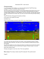
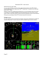
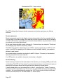
geographic positions of runway thresholds and elevations. This data is accurate (providing of
course that it has been defined accurately in the database). You can consider using the
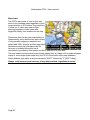
image on the screen to give you initial approach guidance in bad visibility.
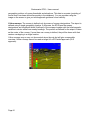
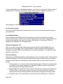
Yellow runways: The runway is defined only by means of runway designations. The airport is
defined using a single geographic location. In this case, the EFIS uses the runway
designations and length and width (if defined) of the runways together with the local magnetic
variation to derive actual true runway headings. The position as defined for the airport is taken
as the center of the runway. If more than one runway is defined, they will be drawn with their
centers overlapping in a single location.
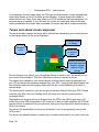
Yellow runways may or may not show actual airport layouts but will give a reasonable
overview. Yellow runways cannot be used as target for a GPS aided approach (GLS
approach).
Page 81